
Trace a Lake Ridge Street by Address
A Lake Ridge street directory begins with a location, then follows the records keyed to that location. USPS confirms a deliverable postal address. County Mapper identifies a parcel and its GPIN. PublicAccessNow supplies the assessment and parcel account view. The Circuit Clerk's index supplies recorded instruments. This sequence can show public parcel, ownership-display, or dated transaction facts. It cannot establish that every owner, grantee, voter, or historical directory name currently lives at the address.
Keep the property or situs address separate from a tax mailing address. A mailing address may be useful as a dated clue, but it can be elsewhere. A map proximity result is also not a household relationship. When the question changes from a street to one named person, the narrower Lake Ridge resident lookup has the verification workflow.
- Validate the postal form with USPS ZIP Lookup.
- Search the address in County Mapper and record GPIN, street components, ZIP, subdivision, phase, section, block, and map date.
- Open the same parcel in PublicAccessNow for assessment, sales, property details, and the legal description.
- Use GPIN or the legal description to find the corresponding deed or plat in PublicSearch.
- For a historical household, consult RELIC's dated criss-cross and directory volumes, then keep the volume and page with the result.
Note: An address-to-parcel match creates a research path, not an occupancy certification or a list of people at the property.
Lake Ridge Street Directory Uses Parcel Keys
PublicAccessNow is the county assessment interface. Its published search pattern has Quick Search, Address Search, GPIN or Account Search, and Sales Search. The county's published tips say an owner-name search is not offered. Begin by address or GPIN, rather than treating the assessor as a broad people finder. The account or RPC is six characters with leading zeros; a GPIN uses the county's xxxx-xx-xxxx pattern.
Result details can show property information, assessment history, building and improvement data, sales, notes, and a map. Assessment ownership display and a physical property address answer different questions. The county assesses real property annually, and the record may change through an update or appeal. A current parcel card therefore needs a result date.
| Search control | Lake Ridge input | Useful result |
|---|---|---|
| Address Search | Street address and unit | Parcel account and property detail |
| GPIN/Account Search | GPIN or six-digit account/RPC | Parcel-specific assessment record |
| Sales Search | Sale-date and amount ranges | Dated sales clues |
| Detail tabs | Chosen parcel | Legal description, history, map, improvements |
The PublicAccessNow portal shown below is the county's address and parcel starting point.
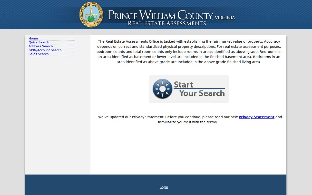
The address and GPIN tools keep the street-directory search tied to an actual county parcel.
Lake Ridge Streets in County Mapper
County Mapper accepts a GPIN, an address, an intersection, or Virginia State Plane coordinates. In an address search, a street name is required and partial matching is supported. Street number and unit are optional, and the street-type control includes choices such as Drive, Road, Court, Lane, Street, Avenue, Boulevard, Circle, Parkway, Place, Terrace, Trail, and Way. A multi-tenant checkbox is available for records the viewer labels that way.
After a result loads, `More Info` may supply parcel-linked schools, precinct, polling place, and overlays. `List Adjoiners` returns adjacent parcels. The viewer also has Land Records, Land Development, service, utility, environment, and aerial-imagery layers. GIS is informational. The county warns that aerial images may not align exactly and boundary corrections can occur as better data arrives.
The following County Mapper view links to the official parcel viewer.
Use the map to identify a parcel and its neighbors, then open separate assessor or clerk records for the question at hand.
Lake Ridge Street Records by Custodian
The Lake Ridge street directory joins records by parcel and address, not by assumptions about a household. Assessment, GIS, deed, plat, permit, and historical directory records each have a different keeper and update cycle. A deed index can identify named parties to a transfer. A permit can identify a public case and the role of a contact. A reverse directory can date a name-to-address association. Read the record type before drawing any conclusion.
| Record Set | Keeper | What It Shows | Access |
|---|---|---|---|
| Assessment parcel card | Tax Administration | Property/owner display, addresses, values, sales | Free address or GPIN search |
| GIS parcel layer | County GIS | GPIN, geometry, street, ZIP, subdivision, adjoiners | Free informational viewer |
| Recorded deed or plat | Circuit Clerk | Named parties, instrument data, legal description | Public index; copy route varies |
| Permit or code case | Development Services | Address, status, dates, contacts and roles | ePortal public search |
| Dated criss-cross entry | RELIC | Historical address, telephone, or name linkage | Library access; not fully digitized |
GPIN, legal description, lot, block, phase, section, and deed book or page are better cross-checks than a street name alone. Street numbering, mailing locality, and subdivision labels can change. The Virginia voter status portal is self or authorized use only, so a parcel's precinct overlay should never be described as a list of voters on that street.
Lake Ridge GPIN Links Maps and Deeds
A GPIN is a county parcel identifier based on a parcel centroid. It is not a subdivision code. Boundary changes can create a new GPIN, and approved plats can lead GIS updates by weeks. The public land-record GIS layer exposes street components, ZIP, subdivision name, landbay, phase, section, block, deed instrument, deed book, deed page, recorded date, acreage, and use description. Those fields make a street search more precise without asserting who occupies a parcel.
The county GPIN guidance explains why the number should be preserved with an address search. A parcel's `LastEditDate` is an edit timestamp, not a deed recordation date. For a split or changed parcel, the county's Parcel History Tree can expose parent or child GPIN relationships.
The county GPIN page shown below explains the parcel identifier used throughout a Lake Ridge street directory search.
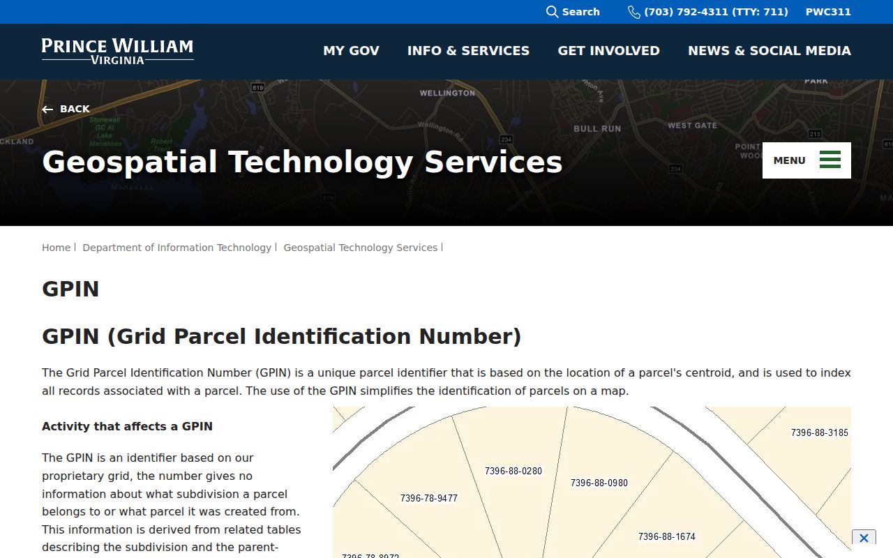
Record the GPIN exactly, then verify it in the separate map, assessment, and land-record systems.
Lake Ridge Permit Searches Add Context
Prince William Development Services uses its public ePortal for permits, plans, inspections, requests, and code cases. The associated guide supports address, permit number, type, work class, status, date, and module searches, plus map parcel selection. Basic public search is free, while some actions require an account. Exports are limited to the first 1,000 results.
A record can show an address or parcel, case number, public dates, status, and named roles. Those roles can include an owner, applicant, authorized representative, contractor, engineer, or other participant. A contact field should be copied with its actual label. The Development Services Records Center is the fallback for stored land-development documents when the online result does not answer the question.
The ePortal source is shown below for an address-specific public case search.

The portal supplements a parcel trail with case information; it does not provide a current resident roster.
Lake Ridge Street Names Need Dates
No official Lake Ridge historical address-conversion table or complete street-renumbering list was located. No Lake Ridge-specific Sanborn sheet or year was found in the official sources either. Do not invent a conversion. For an older street question, compare the GPIN, recorded plat, deed legal description, assessor parcel history, RELIC's 1962 and 1972 maps, and county historical aerial layers.
Lake Ridge development began in 1969. Earlier materials can describe the future community through Prince William land, road, tract, Woodbridge, Occoquan, or Dumfries vocabulary. County Mapper offers 1937 and 2004-2023 aerial years; RELIC's historical maps provide a different dated context. A current road label alone is not enough to connect old and new records.
- Parcel
- A county-mapped land unit with its own identifier and geometry.
- Situs address
- The physical property address used by parcel and permit systems.
- Plat
- A recorded map that can show lots, blocks, phases, roads, and boundaries.
- Criss-cross directory
- A dated reverse directory arranged by address or phone, when the volume has that section.
What a Lake Ridge Street Directory Cannot Show
A street directory cannot establish every person who lives at a parcel. County Mapper does not provide household members, utility customers, delivery data, unlisted telephone information, or protected voter data. A public owner or mailing field and an old directory entry answer limited, dated questions. They should not be expanded into a household list. Virginia DMV personal, driver, and vehicle data is privileged under Va. Code §46.2-208.
Addresses can be substituted or withheld through the Virginia Address Confidentiality Program and protective-order rules. A missing address may be a lawful protection rather than a data problem. The voter portal requires authorization and statutory voter-list releases are purpose-limited. A public map point, GPIN, or nearby parcel is never a reason to contact a person in a result.
Lawful use. Lake Ridge street records support personal, lawful property and family-history research. Using address information to stalk, harass, intimidate, or harm anyone is prohibited and can violate Virginia law.
Lake Ridge Deed Chains Follow Legal Descriptions
Once a parcel is identified, use the legal description or GPIN to locate the matching record in the Circuit Clerk's land-record index. Modern county online-record coverage gives a 1918-present baseline for deeds and related images. HOP, older books, RELIC's deed index, and Library of Virginia microfilm provide historical alternatives. A recorded deed identifies its parties and instrument details. It does not certify current occupancy.
The 1731-1827 deeds index is a useful preservation aid, but it is not a full image set. Its surviving volume covers M-W grantors and grantees, while some books and portions are missing after Civil War disruption. Book, page, remarks, and surname range should remain with every historical result. Current copy and certification charges belong on the clerk's live fee page, not in an assumed flat fee.
Lake Ridge Street History Uses More Than One Map
County GIS provides parcel layers, current geography, and historical aerial imagery. RELIC adds historic maps, local directories, newspapers, and a 1972 Prince William street map. Historic Prince William has a Lake Ridge diary from 1975-1987 and 1970s area photographs. Each source has a date, purpose, and coverage limit. Compare a map year with a deed or plat date before deciding that a road, subdivision, or address existed in the same form.
For a whole named street, use partial street-name and intersection tools to orient the map, then verify each parcel individually. The immediate-block method is narrower and is covered by the Lake Ridge find-neighbors page. The full street trail requires the address, GPIN, records, and historical sources to agree.
Note: County aerial alignment and parcel geometry are informational, so a recorded plat or survey remains the stronger boundary source.
Lake Ridge Street Addresses Need Postal Checks
Postal and parcel systems use different keys. USPS offers By Address, By City and State, and Cities by ZIP Code modes. It can normalize the delivery address and ZIP, but it states that a ZIP result does not confirm a person or company at an address. The Prince William ZIP map identifies 22192 as Woodbridge, Lake Ridge. It also shows nearby Woodbridge, Dale City, Occoquan, Dumfries, and Montclair postal combinations. A Woodbridge line alone does not prove CDP inclusion.
County Mapper is the next step after postal normalization. It can supply parcel street components, ZIP, subdivision, phase, section, block, GPIN, acreage, deed metadata, and map context. Keep a situs address, owner or mailing address, and legal description as separate fields. ZIP is a postal key, GPIN is a parcel key, and the Census CDP is a statistical boundary. The Lake Ridge street directory becomes less error-prone when those labels are never collapsed.
A missing or mismatched result should send the search back to the address, street type, unit, GPIN, legal description, or official map. It is not a reason to infer who lives on a street.
Lake Ridge Street Parcels Have Adjoiners
County Mapper's `List Adjoiners` action returns parcels adjoining a selected parcel. Use it after opening a validated address or GPIN, then use Highlight and More Info to keep the selected property distinct. The result is a geography and parcel relationship, not a neighbor roster. For each adjoining parcel, the relevant fields are GPIN, street and ZIP components, subdivision, phase, section, block, acreage, deed book or page, and recorded date. Follow a GPIN to the assessor and Circuit Clerk separately.
For a longer street segment, partial street-name search, intersection search, pan and zoom, identify rectangle or line tools, and parcel layers can orient the map. Do not call a visual cluster a legal block without a recorded plat. County Mapper's measure tool is useful for a map explanation, but the county describes the viewer as informational rather than a survey. A plat or deed carries the recorded boundary information.
Parcel adjacency is a useful first question for land history and map context. It cannot identify a household, protected voter, utility customer, or person using a mailing address elsewhere.
Lake Ridge Street Deeds Need Instrument Details
The Circuit Clerk land-record index may identify a grantor, grantee, instrument type and number, deed book and page, recorded date, legal description, consideration or tax fields, and related parties when present. The index alone does not establish the facts of a transaction or current ownership. Inspect the available image and record the instrument date. If a certified copy is needed, submit the clerk's copy request with party names, instrument number or deed book and page, pages, and certification choice.
Land records provide an address trail only when the parcel and legal description agree. A tax sale notice, judgment, or old mailing field needs the same caution. Current ownership and mailing information can lag between recordation, assessment updates, and GIS edits. A street directory should say which system supplied a name and when, rather than blending a record chain into an assertion about current residency.
Prince William's online clerk categories have different coverage dates. The modern deed image baseline is 1918-present, and older sources remain collection-specific. Use the Historical Online Portal, clerk books, RELIC, or the Library of Virginia when the date needs a historical route.
Lake Ridge Street Permits Have Role Labels
Development Services ePortal supports a public address trail that is different from a land record. Its search guide describes address, permit number, permit type, work class, status, date, module, export, and map parcel selection. A returned case can be tied to an address or parcel and can include dates, status, documents, inspections, and public contacts. Search results are module-specific and migrated coverage varies, so an unreturned case does not prove that no project existed.
A public contact can be an owner, an authorized representative, contractor, engineer, applicant, or other case participant. Preserve the actual role label. Basic search is public, but some applications, requests, and actions require an account. The Development Services Records Center at 5 County Complex Court is the physical fallback for stored land-development records. It is not a substitute route for deeds, marriages, or vital records.
For a street question, a permit adds a dated public case fact. It does not show a complete household or confirm present occupancy.
Lake Ridge Street Directories Are Historical
RELIC's city and telephone directories provide a separate, dated way to research a street. The most relevant early-locality run is Quantico-Triangle-Dumfries-Woodbridge-Occoquan, 1963-1980. RELIC also holds Prince William County directories for 2001 and 2007-2020 and selected telephone directories. A reverse or criss-cross section can connect a street address or telephone number to an entry in a specific volume. Its field set and coverage are volume-specific.
Lake Ridge's planned development began in 1969. For earlier land, look through the county's historical maps, aerials, deed books, tax lists, and predecessor place names. For later household context, record the directory year, page, spelling, address, entry type, and any owner or renter mark exactly. The city-directory collections page provides the full shelf detail, while the street directory uses that material only to test an address through time.
No digitized local directory entry and no complete online Lake Ridge directory collection was found in the research. Library access and staff help are part of the documented fallback chain.
Lake Ridge Street Results Need a Search Log
For each address, retain the normalized postal form, Lake Ridge or Woodbridge locality label, GPIN, parcel account, legal description, map date, and source URL. Add the deed instrument and date, permit case and role, directory volume and page, or historical map year only when the source matches the same property and period. The log protects against duplicate street names, changed labels, shared surnames, and parcels that were subdivided.
Virginia FOIA is available for reasonably specific existing county records, subject to exemptions and reasonable costs. It does not require a county office to create a street-by-street directory or combine systems into a people list. State and county privacy rules still apply to voter data, protected addresses, vital records, juvenile files, DMV information, and personal identifiers in court or business records.
Note: The strongest Lake Ridge street result identifies the custodian, parcel, record date, and limit before it names what the record actually shows.